|
Paper Plate Education
"Serving the Universe on a Paper
Plate"
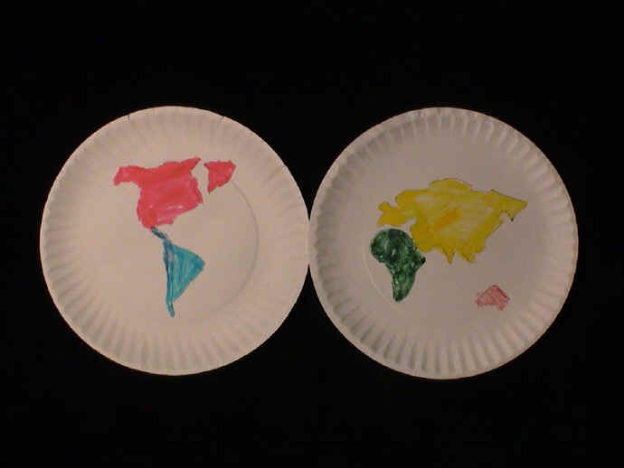
Activity: Hemisphere Maps
Place
two plates side by side—akin to old charts—and make map of world as
individual perceives it.
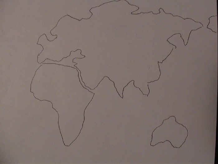
 Onto
paper trace
the continents from an atlas at a scale that will fit on a plate. Onto
paper trace
the continents from an atlas at a scale that will fit on a plate.
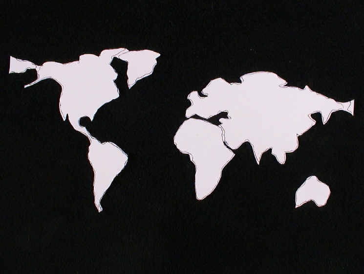
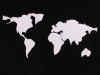 Cut out the continents (and save them for a Plate
Teachtonics lessons)...
Cut out the continents (and save them for a Plate
Teachtonics lessons)...
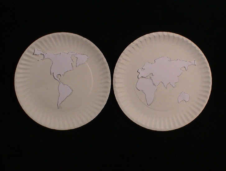
 ...and place the continent outlines on blank plates.
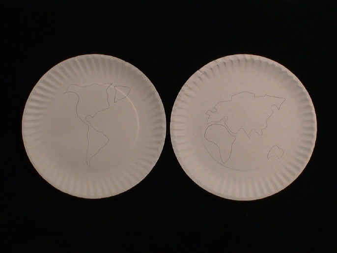
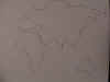
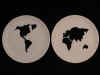
 Trace the continent outlines onto the plates. Antarctica is omitted in this
sample. Trace the continent outlines onto the plates. Antarctica is omitted in this
sample.
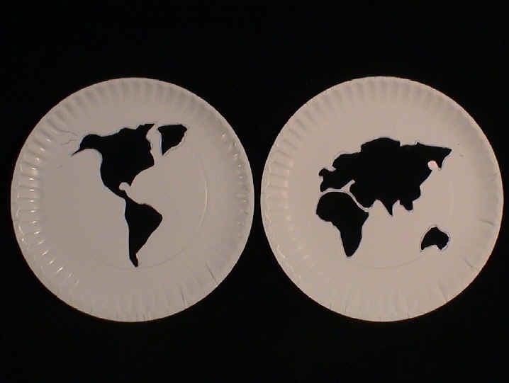
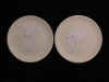
 Cut the
continents out of the plates. Stack this continent template on a cheap,
unwaxed
blank plate to duplicate the continent outlines readily. Cut the
continents out of the plates. Stack this continent template on a cheap,
unwaxed
blank plate to duplicate the continent outlines readily.
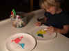 Color in the continents. Color in the continents.
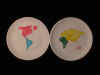
Align the plates side by side and display as a hemisphere map.
Images and text for the following examples of dual-hemisphere and other world maps are courtesy of Garwood &
Voigt, Fine & Rare Books Maps &
Prints.
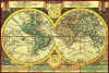
 Pair of maps of the two hemispheres on separate
sheets. California is shown as a large island. The continents are shown in
outline with accentuated chains of mountains. T.Burnet for an edition of
Theory of the Earth c. 1690 [7270] Each hemisphere 18 cms in diameter.
Laid down on thin paper, Western hemisphere with very thinned paper in places.
Shirley 507
Pair of maps of the two hemispheres on separate
sheets. California is shown as a large island. The continents are shown in
outline with accentuated chains of mountains. T.Burnet for an edition of
Theory of the Earth c. 1690 [7270] Each hemisphere 18 cms in diameter.
Laid down on thin paper, Western hemisphere with very thinned paper in places.
Shirley 507
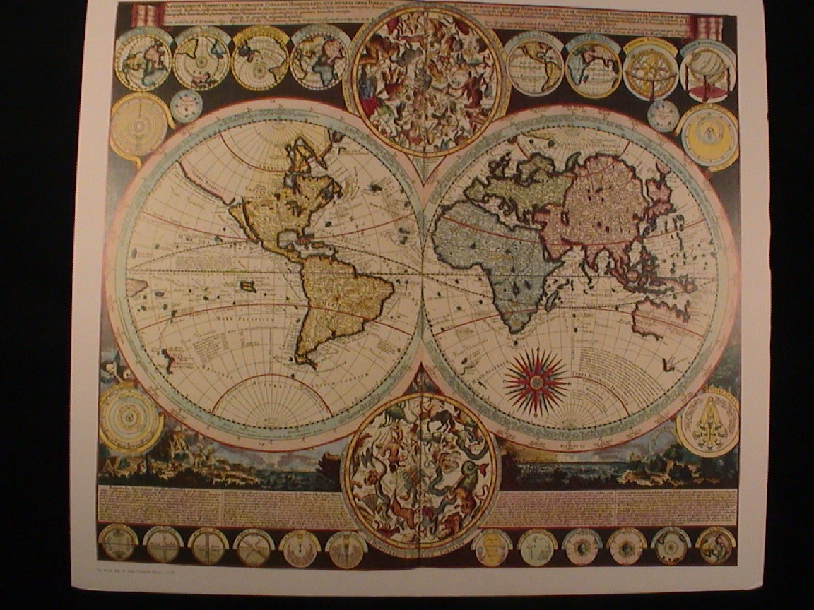
 'GLOBUS
TERRESTRIS...'. Double hemisphere
chart with two small circular diagrams and tables of explanations below. J.G.Schreiber
c. 1750 [14513] 16 x 24 cm. Full original colour. 'GLOBUS
TERRESTRIS...'. Double hemisphere
chart with two small circular diagrams and tables of explanations below. J.G.Schreiber
c. 1750 [14513] 16 x 24 cm. Full original colour.
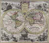 ‘TYPUS ORBIS TERRARUM’. Double
hemisphere world map with figures and scenes in the four corners illustrating
the four continents. Insular California. Peter Conrad Monath in Nürnberg c.
1760 [18174] 25 x 29 cm. Decorative cartouche above and
illustration of a globe below. Full original colour, the figures uncoloured.
‘TYPUS ORBIS TERRARUM’. Double
hemisphere world map with figures and scenes in the four corners illustrating
the four continents. Insular California. Peter Conrad Monath in Nürnberg c.
1760 [18174] 25 x 29 cm. Decorative cartouche above and
illustration of a globe below. Full original colour, the figures uncoloured.
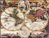 ‘PLANIGLOBII TERRESTRIS MAPPA UNIVERSALIS
... / MAPPE-MONDE QUI REPRESENTE LES DEUX HEMISPHERES...’. Double hemisphere
world map with two uncoloured cartouches, four smaller circular polar
projections and two small circular celestial diagrams. J. M. Haas for Homann
Heirs 1746 [10577] 46 x 55 cm. Original outline colour, the
continents fully coloured. ‘PLANIGLOBII TERRESTRIS MAPPA UNIVERSALIS
... / MAPPE-MONDE QUI REPRESENTE LES DEUX HEMISPHERES...’. Double hemisphere
world map with two uncoloured cartouches, four smaller circular polar
projections and two small circular celestial diagrams. J. M. Haas for Homann
Heirs 1746 [10577] 46 x 55 cm. Original outline colour, the
continents fully coloured.
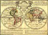 'LE GLOBE TERRESTRE REPRESENTE EN DEUX
PLANS-HEMISPHERES...'. Double hemisphere chart. California is shown as an
island. J.Chiquet c. 1719 [7134] 16 x 22 cm. Elaborately
engr. title cartouche. Original outline Colour. 'LE GLOBE TERRESTRE REPRESENTE EN DEUX
PLANS-HEMISPHERES...'. Double hemisphere chart. California is shown as an
island. J.Chiquet c. 1719 [7134] 16 x 22 cm. Elaborately
engr. title cartouche. Original outline Colour.
 ‘MAPPEMONDE OU DESCRIPTION GENERALE DU GLOBE TERRESTRE’.
Double hemisphere world map in elaborate framework, two astronomical diagrams,
compass rose and large table of explanations below. Insular California. Chatelain
c. 1720 [17688] 33 x 44 cm. Recent outline colour. ‘MAPPEMONDE OU DESCRIPTION GENERALE DU GLOBE TERRESTRE’.
Double hemisphere world map in elaborate framework, two astronomical diagrams,
compass rose and large table of explanations below. Insular California. Chatelain
c. 1720 [17688] 33 x 44 cm. Recent outline colour.
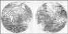
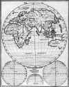 'ORTHOGRAPHIA GEOMETRICA HEMISPHAERII
ORIENTALIS. FOL.Q'. H.Scherer c. 1700 [7261] 24 x 19 cm.
Three astronomical diagrams below.
'ORTHOGRAPHIA GEOMETRICA HEMISPHAERII
ORIENTALIS. FOL.Q'. H.Scherer c. 1700 [7261] 24 x 19 cm.
Three astronomical diagrams below.
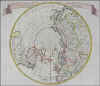 ‘NUOVA CARTA DEL POLO ARTICO...’. North Polar
projection, insular California. Tirion c. 1738 [15600] 28 x 32 cm.
Previously folded. Recent outline Colour.
‘NUOVA CARTA DEL POLO ARTICO...’. North Polar
projection, insular California. Tirion c. 1738 [15600] 28 x 32 cm.
Previously folded. Recent outline Colour.
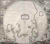 ‘POLI ARCTICI ET CIRCUMIACENTIUM TERRARUM DESCRIPTIO
NOVISSIMA’. Circular map of the North Pole incl. Northern Europe, Russia,
Greenland and Canada. Central cartouche. Decorative vivid whaling scenes
surrounding the map. Henricus Hondius 1638 [18046] 43 x 49 cm.
Burden 246/3. Uncoloured. ‘POLI ARCTICI ET CIRCUMIACENTIUM TERRARUM DESCRIPTIO
NOVISSIMA’. Circular map of the North Pole incl. Northern Europe, Russia,
Greenland and Canada. Central cartouche. Decorative vivid whaling scenes
surrounding the map. Henricus Hondius 1638 [18046] 43 x 49 cm.
Burden 246/3. Uncoloured.
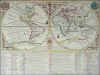
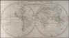 ‘A NEW MAP OF THE WORLD SHEWING THE COURSE OF SR. FRANCIS
DRAKE, WILLIAM SCHOUTEN AND CAPT. WILLIAM DAMPIER’S VOYAGES ROUND IT’.
Double hemisphere world map, showing California as an island. Anonymous, but
from Harris/Compleat Collection of Voyages c. 1705 [17878] 29 x 54 cm.
Excellent condition, uncoloured.
‘A NEW MAP OF THE WORLD SHEWING THE COURSE OF SR. FRANCIS
DRAKE, WILLIAM SCHOUTEN AND CAPT. WILLIAM DAMPIER’S VOYAGES ROUND IT’.
Double hemisphere world map, showing California as an island. Anonymous, but
from Harris/Compleat Collection of Voyages c. 1705 [17878] 29 x 54 cm.
Excellent condition, uncoloured.
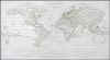 ‘PLANIGLOBIEN’. Double hemisphere world map. J.Boreux
[for F. W. Streit], publ. by Hinrichs in Leipzig c. 1830 [16548] 25 x 50 cm.
Faint original outline colour. Side margins closely trimmed. Uncommon. ‘PLANIGLOBIEN’. Double hemisphere world map. J.Boreux
[for F. W. Streit], publ. by Hinrichs in Leipzig c. 1830 [16548] 25 x 50 cm.
Faint original outline colour. Side margins closely trimmed. Uncommon.
Contributed by Chuck Bueter.
|