![]()
![]()
![]()
![]()
![]()
![]()
|
|
|
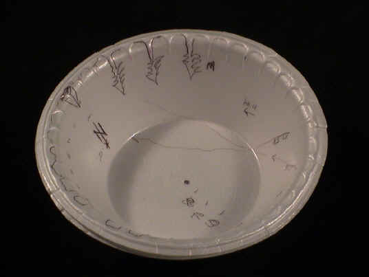
Paper Plate Education Activity: Satellite Tracking Dish
Create a device that depicts the path of visible satellites, the International Space Station, and the Space Shuttle. On the inside of a foam bowl, which will later be held over one’s head, label cardinal points and draw 360 degrees of local horizon features in their respective positions. (Note: Hefty® foam bowls have scalloped edges that conveniently are 10 degrees apart. Label the azimuth in 10-degree increments.) From the edge of the bowl to the center, subdivide and label zero- to 90-degrees of azimuth. Obtain
current predictions on satellite passes for your location from the Heavens-Above website at http://www.heavens-above.com. Plot the predicted track across the bowl and label each line
with time and satellite name.
Also see NASA Human Space Flight for real time data and tips for viewing the International Space Station and the Space Shuttle. Contributed by Chuck Bueter. GLPA Proceedings, 1999; pp. 35-36. [Note: This activity is included in the Paper Plate Astronomy video/DVD/streaming video.] |
|
Copyright ©2012 Chuck Bueter. All rights reserved. |